सिर्फ ठंड नहीं… ये छुपी कमी फाड़ रही है आपके होंठ!..यहां जानिए सही इलाज – Uttarakhand News
Last Updated:December 12, 2025, 16:22 IST
डॉ राजकुमार (आयुष) ने कहा कि सर्दियों में नमी कम हो जाती है जिससे होंठ जल्दी सूखने लगते हैं. लेकिन सिर्फ ठंड ही जिम्मेदार नहीं है. शरीर में कुछ खास विटामिन की कमी भी होंठों को फटने और पपड़ी जमने का कारण बनती है. खासतौर पर विटामिन B2, विटामिन B3 और विटामिन B12 की कमी होने पर होंठों की नमी तेजी से घटती है
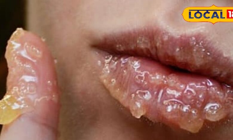
सर्दियों में नमी कम हो जाती है जिससे होंठ जल्दी सूखने लगते हैं. लेकिन सिर्फ ठंड ही जिम्मेदार नहीं है. शरीर में कुछ खास विटामिन की कमी भी होंठों को फटने और पपड़ी जमने का कारण बनती है. खासतौर पर विटामिन B2, विटामिन B3 और विटामिन B12 की कमी होने पर होंठों की नमी तेजी से घटती है. इससे लिप कॉर्नर फटना, जलन और दर्द जैसी दिक्कतें होने लगती हैं जो सर्दियों में ज्यादा बढ़ जाती हैं.

विटामिन B2 जिसे राइबोफ्लेविन कहा जाता है, त्वचा और होंठों की कोशिकाओं की मरम्मत के लिए जरूरी होता है. इसकी कमी से होंठों पर पपड़ी, सूखापन और कोनों में दर्द होने लगता है. सर्दियों में शरीर को यह विटामिन कम मिलता है तो होंठ तेजी से फट सकते हैं. इस विटामिन की कमी आमतौर पर कमजोर डाइट, कम पानी पीने और ज्यादा धूप से बचने के कारण बढ़ जाती है जिससे होंठ संवेदनशील हो जाते हैं.

विटामिन B12 की कमी से त्वचा सूखने, होंठ पपड़ी बनने और कोनों में कट लगने की समस्या बढ़ जाती है. यह विटामिन खून को स्वस्थ रखने के साथ कोशिकाओं में नमी बनाए रखने में मदद करता है. जब इसका स्तर गिर जाता है तो होंठ आसानी से फटते हैं और बार-बार लिप बाम लगाने के बाद भी राहत नहीं मिलती. खासकर सर्दियों में B12 की कमी होंठों की स्किन को ज्यादा रफ और डैमेज्ड बना देती है.
Add as Preferred Source on Google

विटामिन B3 यानि नायसिन त्वचा के टेक्सचर को ठीक रखने और नमी बनाए रखने में अहम भूमिका निभाता है. इसकी कमी से होंठों का रंग गहरा होना, सूखना और पपड़ी जमा होना शुरू हो जाता है. यह कमी शरीर में हीलिंग प्रोसेस को भी धीमा कर देती है. सर्दियों में नायसिन की डाइट कम होने पर होंठों पर सफेद लाइनें दिखना और लगातार क्रैक होना आम बात है जिससे दर्द भी बढ़ सकता है.

सिर्फ विटामिन की कमी ही नहीं, बल्कि सर्दियों में पानी कम पीना भी होंठ फटने की बड़ी वजह है. ठंड लगने पर प्यास कम लगती है और शरीर अंदर से डिहाइड्रेट हो जाता है. इसकी वजह से होंठों तक पर्याप्त नमी नहीं पहुंच पाती. अगर विटामिन B कॉम्प्लेक्स की कमी के साथ पानी भी कम पिया जाए तो होंठ तेज़ी से सूखते हैं. इस स्थिति में छोटे कट और खून निकलने जैसी परेशानियां भी हो सकती हैं.

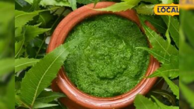
फटे होंठों को ठीक करने के लिए घर में मौजूद चीजें बहुत फायदेमंद होती हैं. देसी घी होंठों को तुरंत नमी देता है और पपड़ी नरम करता है. शहद में एंटीबैक्टीरियल गुण होते हैं जो कटे होंठों को जल्दी भरते हैं. एलोवेरा जेल लगाने से जलन कम होती है और स्किन को ठंडक मिलती है. रात में सोने से पहले नारियल तेल लगाने से होंठों की नमी लॉक रहती है जिससे सुबह तक होंठ मुलायम रहते हैं.

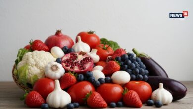
होंठ फटने से रोकने के लिए डाइट में विटामिन B2, B3 और B12 से भरपूर चीजें शामिल करनी चाहिए. दूध, दही, अंडे, पनीर, बादाम, मूंगफली और हरी सब्जियां इन विटामिन्स के अच्छे स्रोत हैं. इसके अलावा साबुत अनाज और केला भी होंठ फटने में राहत देते हैं. सर्दियों में रोज थोड़ा सा मक्खन या घी खाना भी फायदेमंद होता है. सही डाइट न सिर्फ होंठ बल्कि पूरी त्वचा को अंदर से पोषण देती है.
न्यूज़18 को गूगल पर अपने पसंदीदा समाचार स्रोत के रूप में जोड़ने के लिए यहां क्लिक करें।First Published :
December 12, 2025, 15:13 IST
homelifestyle
सिर्फ ठंड नहीं… ये छुपी कमी फाड़ रही है आपके होंठ!